
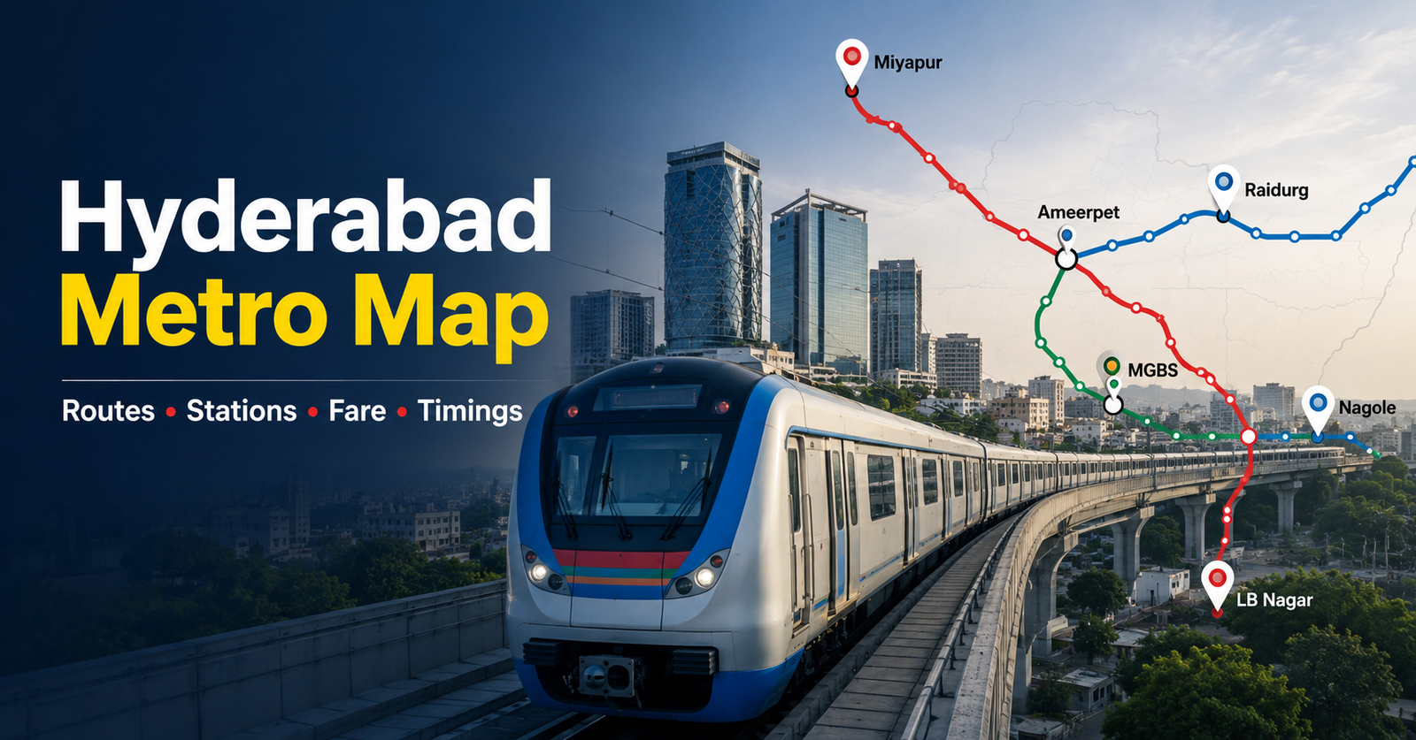
You are probably searching for the Hyderabad Metro Map because you want to plan your daily commute, locate the nearest metro station, or decide whether buying a home near a metro corridor is worth the extra investment. With Hyderabad expanding rapidly towards the IT corridor and western suburbs, metro connectivity has become one of the biggest factors influencing both travel convenience and property prices.
According to Hyderabad Metro Rail Limited (HMRL), the network carries over 4 lakh passengers on busy weekdays, making it one of India’s busiest metro systems. As traffic congestion continues to increase across areas like Madhapur, Kukatpally, Ameerpet, and LB Nagar, choosing the right metro route can save you thousands of rupees every month.
But understanding the network isn’t always easy. Many websites simply list station names without explaining interchanges, fares, travel times, or what metro connectivity actually means if you’re planning to rent or buy property nearby.
In this detailed guide, you’ll learn everything about the Hyderabad Metro Map, including all operational routes, station lists, fares, timings, PDF map, Phase 2 expansion, and how metro connectivity influences Hyderabad’s real estate market.
Index
- What is Hyderabad Metro?
- Hyderabad Metro Map 2026
- Hyderabad Metro Green Line
- Hyderabad Metro Stations List
- Interchange Stations Explained
- Hyderabad Metro Timings
- Hyderabad Metro Fare Structure 2026
- Hyderabad Metro Fare Comparison
- Hyderabad Metro Map PDF
- Hyderabad Metro Map Telugu
- Hyderabad Metro Map Phase 2 (Latest 2026 Update)
- Hyderabad Metro Map and Property Prices: Does Metro Connectivity Increase Home Value?
- Areas Benefiting the Most
- Hyderabad Metro vs Other Daily Transport Options
- Common Mistakes People Make While Using the Hyderabad Metro Map
- Expert Tips for Homebuyers and Daily Commuters
- Frequently Asked Questions (FAQs)
- Conclusion
What is Hyderabad Metro?
Hyderabad Metro Rail is India’s largest Public-Private Partnership (PPP) metro project, developed by Hyderabad Metro Rail Limited (HMRL) in partnership with L&T Metro Rail Hyderabad.
Today, the operational network stretches across approximately 69 kilometres, connecting residential suburbs, commercial centres, educational institutions, railway stations, shopping districts and Hyderabad’s famous IT corridor.
Unlike traditional city buses, metro trains operate on elevated tracks, allowing commuters to avoid traffic bottlenecks during peak office hours.
For daily office-goers travelling between Miyapur, Kukatpally, Ameerpet, Begumpet, HITEC City and Raidurg, metro travel often cuts commuting time by 40–60%.
For example:
| Travel Mode | Miyapur to HITEC City | Approx. Cost |
|---|---|---|
| Cab | 45–70 minutes | ₹350–₹450 |
| Auto | 60 minutes | ₹220–₹300 |
| Metro | 26–30 minutes | ₹45 |
That means a professional commuting five days a week can save ₹6,000–₹9,000 every month by using the metro instead of app-based taxis.
If you’re planning to buy a home in Hyderabad, metro connectivity also plays a major role in rental demand and long-term appreciation.
Related: How Location Affects Property Value in India
Hyderabad Metro Map 2026
The Hyderabad Metro Map currently consists of three operational corridors covering the city’s busiest residential and commercial destinations.
The official network map provided by Hyderabad Metro Rail Limited clearly shows all operational routes and interchange stations. Your uploaded map is the latest visual representation of the current network and can be used as a reference while planning your journey.
Hyderabad Metro Network at a Glance
| Metro Line | Route | Approx Length | Stations |
|---|---|---|---|
| Red Line | Miyapur → LB Nagar | 29 km | 27 |
| Blue Line | Raidurg → Nagole | 28 km | 23 |
| Green Line | JBS Parade Ground → MGBS | 11 km | 10 |
Total Network
- 69+ km
- 57 operational stations
- Three interchange stations
- One of India’s longest elevated metro systems
Unlike Delhi Metro, Hyderabad Metro mainly serves residential neighbourhoods and the western IT corridor, making it particularly valuable for software professionals.
Major Areas Connected
The metro network connects:
- Miyapur
- Kukatpally
- KPHB
- Ameerpet
- Begumpet
- Secunderabad
- Punjagutta
- Lakdikapul
- HITEC City
- Durgam Cheruvu
- Raidurg
- Nagole
- LB Nagar
- MGBS
- Parade Ground
This extensive coverage allows commuters to travel across the city without relying heavily on road transport.
Hyderabad Metro Red Line
The Red Line is the longest and one of the busiest corridors in Hyderabad Metro.
Route
Miyapur → LB Nagar
This corridor connects western residential suburbs with central Hyderabad and eastern neighbourhoods.
Important Stations
- Miyapur
- JNTU College
- KPHB Colony
- Kukatpally
- Balanagar
- Moosapet
- Bharat Nagar
- Erragadda
- ESI Hospital
- SR Nagar
- Ameerpet
- Punjagutta
- Irrum Manzil
- Khairatabad
- Lakdikapul
- Assembly
- Nampally
- Gandhi Bhavan
- Osmania Medical College
- MG Bus Station
- Malakpet
- New Market
- Musarambagh
- Dilsukhnagar
- Chaitanyapuri
- Victoria Memorial
- LB Nagar
Why This Line Matters
The Red Line is especially useful for:
- Government employees
- Students
- Daily office commuters
- Homebuyers looking around Miyapur and Kukatpally
A 2BHK apartment in Miyapur typically rents for ₹18,000–₹24,000, while a similar property in Banjara Hills can easily exceed ₹38,000. Metro access helps residents enjoy lower housing costs without sacrificing connectivity.
Hyderabad Metro Blue Line
The Blue Line is considered Hyderabad’s technology corridor.
It connects Hyderabad’s major IT hubs with eastern residential areas.
Route
Raidurg → Nagole
This corridor is the preferred choice for thousands of IT professionals working in:
- HITEC City
- Madhapur
- Financial District (via feeder transport)
- Durgam Cheruvu
- Cyber Towers
Major Stations
- Raidurg
- HITEC City
- Durgam Cheruvu
- Madhapur
- Peddamma Temple
- Jubilee Hills Check Post
- Road No. 5 Jubilee Hills
- Yousufguda
- Madhura Nagar
- Ameerpet
- Begumpet
- Prakash Nagar
- Rasoolpura
- Paradise
- Parade Ground
- Secunderabad East
- Mettuguda
- Tarnaka
- Habsiguda
- NGRI
- Stadium
- Uppal
- Nagole
Why Professionals Prefer This Line
Someone travelling daily from Uppal to HITEC City can save approximately:
| Mode | Daily Cost | Monthly Cost |
|---|---|---|
| Cab | ₹700 | ₹14,000 |
| Metro | ₹90 | ₹1,800 |
That’s a saving of over ₹12,000 every month.
For buyers, homes near Raidurg, HITEC City, and Madhapur generally command higher prices due to strong demand from IT professionals.
Hyderabad Metro Green Line
The Green Line is the shortest corridor in the Hyderabad Metro network, but it plays a crucial role by connecting Secunderabad Cantonment, Parade Ground, and Mahatma Gandhi Bus Station (MGBS). It provides seamless connectivity between railway stations, bus terminals, and the other two metro lines.
Although this corridor is smaller than the Red and Blue Lines, it carries thousands of commuters every day who travel between Secunderabad and central Hyderabad.
Route
JBS Parade Ground → MGBS
Hyderabad Metro Green Line Stations
- JBS Parade Ground
- Secunderabad West
- Gandhi Hospital
- Musheerabad
- RTC X Roads
- Chikkadpally
- Narayanguda
- Sultan Bazaar
- MGBS
Note: Parade Ground is the interchange station with the Blue Line, while MGBS connects with the Red Line, allowing passengers to travel across all three metro corridors without leaving the metro system.
Who benefits most from this line?
The Green Line is particularly useful for:
- Students travelling to educational institutions near RTC X Roads
- Railway passengers arriving at Secunderabad
- Bus travellers using Mahatma Gandhi Bus Station
- Government employees working in central Hyderabad
- Tourists visiting historical areas around Sultan Bazaar
For example, travelling from RTC X Roads to MGBS takes around 10 minutes by metro, compared to 25–40 minutes by road during peak traffic.
If you’re planning to buy property near Musheerabad or Chikkadpally, the Green Line has improved accessibility significantly. While prices are still lower than those in HITEC City or Jubilee Hills, metro connectivity has boosted rental demand among students and office workers.
Hyderabad Metro Stations List
One of the biggest reasons people search for the Hyderabad Metro stations list is to identify the nearest station to their home, office, or destination. Knowing the correct station can save both travel time and money, especially if you’re planning a daily commute.
Below is the complete operational stations list grouped by metro line.
🔴 Red Line Stations
- Miyapur
- JNTU College
- KPHB Colony
- Kukatpally
- Balanagar
- Moosapet
- Bharat Nagar
- Erragadda
- ESI Hospital
- SR Nagar
- Ameerpet
- Punjagutta
- Irrum Manzil
- Khairatabad
- Lakdikapul
- Assembly
- Nampally
- Gandhi Bhavan
- Osmania Medical College
- MGBS
- Malakpet
- New Market
- Musarambagh
- Dilsukhnagar
- Chaitanyapuri
- Victoria Memorial
- LB Nagar
🔵 Blue Line Stations
- Raidurg
- HITEC City
- Durgam Cheruvu
- Madhapur
- Peddamma Temple
- Jubilee Hills Check Post
- Road No. 5 Jubilee Hills
- Yousufguda
- Madhura Nagar
- Ameerpet
- Begumpet
- Prakash Nagar
- Rasoolpura
- Paradise
- Parade Ground
- Secunderabad East
- Mettuguda
- Tarnaka
- Habsiguda
- NGRI
- Stadium
- Uppal
- Nagole
🟢 Green Line Stations
- Parade Ground
- Secunderabad West
- Gandhi Hospital
- Musheerabad
- RTC X Roads
- Chikkadpally
- Narayanguda
- Sultan Bazaar
- MGBS
The latest official route map uploaded for this article also shows the complete operational station network.
Interchange Stations Explained
Interchange stations are where passengers can switch from one metro line to another without exiting the station. These stations reduce travel time dramatically and are among the busiest locations in Hyderabad Metro.
| Station | Connected Lines | Importance |
|---|---|---|
| Ameerpet | Red ↔ Blue | Hyderabad’s busiest interchange |
| Parade Ground | Blue ↔ Green | Connects Secunderabad to the IT corridor |
| MGBS | Red ↔ Green | Links the city bus terminal with metro |
Why do interchange stations matter?
Suppose you live in LB Nagar and work in HITEC City.
Without an interchange:
- You would need a bus or cab after reaching Ameerpet.
With the metro interchange:
- Simply switch from the Red Line to the Blue Line.
- Total travel time: around 45–50 minutes.
- Approximate fare: ₹60.
A similar cab ride during rush hour can cost ₹450–₹600, making the metro a much more economical option.
From a real estate perspective, homes located within 500 metres to 1 kilometre of interchange stations generally attract stronger rental demand. Working professionals prefer these locations because they can access the entire metro network without multiple road transfers.
Hyderabad Metro Timings
One of the most searched terms is Hyderabad Metro timings, especially among office-goers and first-time visitors.
Metro trains operate seven days a week, including most public holidays, with frequent services during peak office hours.
Hyderabad Metro Timings
| Particular | Time |
|---|---|
| First Train | Around 6:00 AM |
| Last Train | Around 11:00 PM |
| Peak Hour Frequency | Every 3–5 minutes |
| Non-Peak Frequency | Every 6–8 minutes |
| Weekend Frequency | 5–7 minutes |
| End-to-End Journey | Approximately 85–90 minutes |
Peak Hours
- 8:00 AM – 10:30 AM
- 5:30 PM – 8:30 PM
These periods usually experience the highest passenger traffic, particularly at:
- Ameerpet
- HITEC City
- Raidurg
- Parade Ground
- Miyapur
If your office timing is flexible, travelling before 8:00 AM or after 10:30 AM can make your journey much more comfortable.
Example
A commuter travelling from Nagole to HITEC City during peak hours may spend:
- Waiting time: 3–5 minutes
- Travel time: 42–45 minutes
- Total journey: under 50 minutes
The same trip by car during heavy traffic often exceeds 90 minutes.
Hyderabad Metro Fare Structure 2026
Hyderabad Metro follows a distance-based fare system, making it affordable for both short and long-distance travel.
The minimum fare starts at ₹10, while the maximum fare for the longest journey is around ₹60.
Hyderabad Metro Fare Comparison
| Distance | Metro Fare | Auto Fare | Cab Fare |
|---|---|---|---|
| Up to 2 km | ₹10 | ₹50–₹80 | ₹120–₹180 |
| 5–10 km | ₹25–₹35 | ₹150–₹220 | ₹220–₹350 |
| 10–20 km | ₹40–₹50 | ₹250–₹350 | ₹350–₹500 |
| 20+ km | ₹60 | ₹400–₹600 | ₹500–₹800 |
Example 1
Miyapur → Ameerpet
- Metro: ₹40
- Auto: ₹250
- Cab: ₹350
Daily savings:
₹300
Monthly savings (22 office days):
₹6,600
Example 2
Nagole → Raidurg
- Metro: ₹60
- Cab: ₹550
Monthly commuting savings can exceed ₹10,000, especially for IT professionals travelling to Cyber Towers or Financial District.
This predictable travel cost also helps homebuyers estimate their monthly budget more accurately before deciding on an EMI.
Related: Home Loan EMI Calculator
Hyderabad Metro Map PDF
Many commuters prefer downloading the Hyderabad Metro Map PDF so they can access station information without an internet connection.
The latest official network map published by Hyderabad Metro Rail can be saved on your phone or printed for reference. It clearly marks:
- Red Line
- Blue Line
- Green Line
- Interchange stations
- Terminal stations
- Major city landmarks
Hyderabad Metro Map Telugu
If you’re more comfortable reading in Telugu, Hyderabad Metro also provides passenger information, station signboards, and announcements in Telugu, English, and Hindi.
The Hyderabad Metro map Telugu version is especially useful for:
- Senior citizens
- Local commuters
- First-time passengers
- Visitors travelling with family
Most station ticket counters also provide assistance in Telugu, making it easier to purchase tickets, recharge smart cards, or locate the correct platform.
Hyderabad Metro Map Phase 2 (Latest 2026 Update)
One of the fastest-growing search terms today is Hyderabad Metro Map Phase 2. That’s because Hyderabad’s western suburbs, airport corridor, and emerging residential hubs continue to expand, creating demand for better public transport.
The Telangana Government has approved Phase 2 expansion plans to improve connectivity between residential neighbourhoods, IT parks, educational institutions, and Rajiv Gandhi International Airport (RGIA). Once completed, the expansion will significantly reduce travel time for lakhs of commuters.
Unlike Phase 1, which primarily connected established residential and commercial areas, Phase 2 focuses on future growth corridors where real estate development is accelerating.
Proposed Hyderabad Metro Phase 2 Corridors
| Proposed Corridor | Approx. Length | Status (2026) |
|---|---|---|
| Raidurg – Shamshabad Airport | 31 km | Approved/Planning |
| Nagole – LB Nagar Extension | Proposed | DPR Stage |
| BHEL – Lakdikapul | Proposed | Planning |
| Miyapur – Patancheru | Proposed | Under Evaluation |
Important: Before buying a property solely because of a proposed metro route, verify whether the corridor has received final approval and construction funding. Property prices often rise on rumours long before actual work begins.
Why Phase 2 Matters
Hyderabad continues to grow towards:
- Kokapet
- Neopolis
- Financial District
- Narsingi
- Shamshabad
- Patancheru
These areas are already attracting major residential projects from builders such as My Home, Aparna, Prestige, and Rajapushpa. Better metro connectivity could further increase demand, especially among salaried professionals working in the IT sector.
For example, a software engineer commuting from Kokapet to Raidurg currently spends 40–60 minutes by road during peak traffic. An operational metro corridor could reduce this to 20–25 minutes, making these locations even more attractive for homebuyers.
You can track official project updates through the Hyderabad Metro Rail Limited (HMRL) and Government of Telangana websites instead of relying on social media rumours.
Hyderabad Metro Map and Property Prices: Does Metro Connectivity Increase Home Value?
If you’re planning to buy a flat in Hyderabad, the Hyderabad Metro Map is more than a travel guide it can help you make a smarter property investment.
Across major Indian cities such as Delhi, Bengaluru, Pune, and Hyderabad, homes located near operational metro stations often enjoy:
- Higher rental demand
- Better resale value
- Faster appreciation
- Lower vacancy rates
Why? Because buyers increasingly value time savings as much as square footage.
Imagine two similar 2BHK apartments priced at ₹85 lakh:
- Apartment A is 300 metres from a metro station.
- Apartment B is 5 km away, requiring a daily auto ride.
Even if Apartment A costs ₹3–5 lakh more, the savings on commuting can outweigh the difference over several years.
Monthly Commute Cost Comparison
| Mode | Monthly Travel Cost |
|---|---|
| Personal Car | ₹9,000–₹14,000 |
| Cab | ₹12,000–₹18,000 |
| Metro | ₹2,500–₹3,500 |
For a family with two working professionals, annual savings can exceed ₹1 lakh.
Those savings can instead be directed towards:
- Higher home loan EMI
- SIP investments
- Emergency fund
- Children’s education
Related: Home Loan Eligibility Calculator
Areas Benefiting the Most
Miyapur
One of Hyderabad’s most popular affordable residential markets.
Average apartment price:
₹6,500–₹8,000 per sq. ft.
Strong demand comes from metro commuters travelling to Ameerpet and HITEC City.
Kukatpally
A mature residential locality with excellent schools, shopping malls, and direct metro access.
Typical 2BHK Rent:
₹22,000–₹30,000
Ameerpet
Thanks to its Red–Blue Line interchange, Ameerpet remains one of Hyderabad’s strongest rental markets.
Professionals can reach almost every major business district from here.
HITEC City & Raidurg
These stations serve Hyderabad’s largest IT employment hub.
Average apartment prices often exceed:
₹10,000–₹15,000 per sq. ft.
Rental demand remains consistently high due to multinational companies.
Uppal
Still comparatively affordable compared to western Hyderabad.
Metro connectivity has increased interest among first-time buyers looking for better value.
Hyderabad Metro vs Other Daily Transport Options
Choosing between the metro, bus, cab, or your own vehicle depends on both cost and convenience.
Here’s a realistic comparison for a 15 km one-way office commute.
| Parameter | Metro | TSRTC Bus | Cab | Personal Car |
|---|---|---|---|---|
| Daily Cost | ₹90 | ₹70 | ₹700 | ₹450 |
| Monthly Cost | ₹1,980 | ₹1,540 | ₹15,400 | ₹9,900 |
| Peak-Time Reliability | Excellent | Moderate | Low | Low |
| Parking Required | No | No | No | Yes |
| Travel Time | 35–40 min | 60 min | 50–90 min | 60–90 min |
Which option offers the best value?
- Metro is the best balance of cost and travel time.
- TSRTC buses are cheaper but slower.
- Cabs provide comfort but become expensive for daily travel.
- Personal vehicles involve fuel, maintenance, parking, and insurance costs.
If your monthly EMI is already stretching your budget, reducing travel expenses through metro connectivity can make a noticeable difference.
Common Mistakes People Make While Using the Hyderabad Metro Map
Many commuters only look at the nearest station instead of understanding the complete network. That often results in longer journeys or unnecessary expenses.
1. Ignoring Interchange Stations
Choosing a house near Ameerpet or Parade Ground often provides better connectivity than living near a terminal station. Interchange stations reduce travel time because you can access multiple corridors easily.
2. Buying Property Based Only on Proposed Metro Lines
Developers sometimes advertise “future metro connectivity” to justify higher prices. Always verify whether the project appears in official government notifications before paying a premium.
3. Not Checking Last-Mile Connectivity
A station may be just 2 km away, but poor roads or limited auto availability can still make your commute inconvenient. Ideally, choose homes within 500 metres to 1 kilometre of an operational station.
4. Travelling During Peak Hours Without Planning
Office rush hours between 8:00–10:30 AM and 5:30–8:30 PM are the busiest. Starting just 20–30 minutes earlier can make your journey much more comfortable.
5. Ignoring Smart Cards and Digital Tickets
Regular commuters should use a rechargeable smart card or digital QR ticket instead of purchasing a paper token every day. This reduces waiting time at stations and makes travel smoother.
6. Not Considering Commute Cost Before Buying a Home
Many buyers compare only apartment prices. They forget that spending ₹10,000–₹15,000 every month on fuel or cabs can be more expensive than paying slightly more for a home near a metro station.
Expert Tips for Homebuyers and Daily Commuters
1. Prioritise Operational Metro Corridors
An operational station offers immediate benefits. Proposed routes may take years to become functional, so don’t overpay based on future promises.
2. Stay Within Walking Distance
A home located within 500 metres to 1 kilometre of a metro station generally enjoys better resale value and stronger tenant demand.
3. Factor Travel Savings into Your EMI Budget
If metro connectivity saves you ₹7,000–₹10,000 every month, that amount can comfortably support a slightly higher home loan EMI without increasing your overall monthly expenses.
4. Choose Interchange Corridors for Better Flexibility
Ameerpet, Parade Ground, and MGBS provide access to multiple metro lines, making future job changes or office relocations easier.
5. Verify Metro Information from Official Sources
Before making any property decision, check official updates from Hyderabad Metro Rail Limited instead of relying on advertisements or social media posts.
6. Look Beyond Property Price
Sometimes paying ₹3–5 lakh extra for a well-connected apartment can save you much more in commuting costs over the next decade while also improving resale value.
Frequently Asked Questions (FAQs)
Where can I download the latest Hyderabad Metro Map PDF?
You can download the latest Hyderabad Metro Map PDF from the official Hyderabad Metro Rail Limited (HMRL) website. The PDF includes all operational metro lines, interchange stations, terminal stations, and route information. It’s useful for offline access when you’re travelling or planning your daily commute. You can also refer to the official network map included in this guide.
What are the Hyderabad Metro timings in 2026?
Hyderabad Metro generally operates from around 6:00 AM until 11:00 PM, although the exact first and last train timings may vary slightly depending on the station and line. During office hours, trains typically arrive every 3–5 minutes, while off-peak frequency is about 6–8 minutes. If you commute daily, checking the latest schedule before travelling is always a good idea.
Which Hyderabad Metro line connects HITEC City and the IT corridor?
The Blue Line connects Hyderabad’s major IT hubs, including HITEC City, Raidurg, Durgam Cheruvu, Madhapur, and Jubilee Hills. Thousands of professionals working in Cyber Towers, Financial District, and nearby business parks rely on this corridor every day. If you’re planning to buy a home for rental income, properties near these stations generally experience strong demand from IT employees.
4. Does Hyderabad Metro directly connect to Rajiv Gandhi International Airport?
No. As of 2026, Hyderabad Metro does not provide a direct connection to Rajiv Gandhi International Airport (RGIA). However, an Airport Metro Corridor is part of the approved Phase 2 expansion plan. Until that corridor becomes operational, travellers can use TSRTC Pushpak Airport Liner buses, airport taxis, or app-based cab services from major metro stations such as Raidurg, Begumpet, or Secunderabad.
Does living near the Hyderabad Metro increase property value?
In many cases, yes. Properties located within walking distance of an operational metro station often enjoy stronger rental demand, better resale potential, and faster appreciation compared to similar homes in less-connected areas. However, don’t rely only on proposed metro projects. Always verify the operational status of the corridor, check actual walking distance, and consider factors such as schools, hospitals, and employment hubs before making a purchase.
Conclusion
The Hyderabad Metro Map has become much more than a city transport guide. It helps you estimate your daily travel time, reduce commuting costs, and even identify neighbourhoods with stronger long-term real estate potential. Whether you’re an office commuter, student, investor, or first-time homebuyer, understanding Hyderabad’s metro network can help you make smarter financial decisions.
Key Takeaways
- Hyderabad Metro currently operates three major corridors covering approximately 69 km and 57 stations.
- The Red, Blue, and Green Lines connect Hyderabad’s residential areas, business districts, and IT hubs efficiently.
- Living within 500 metres to 1 km of an operational metro station can improve convenience and support better property appreciation.
- Phase 2 is expected to expand connectivity to new growth corridors, including the airport route.
- Compare commuting costs alongside your home loan EMI to make a more informed buying decision.
If you’re planning to purchase a home near a metro corridor, don’t just compare property prices. Also calculate how much you can save every month on commuting. Those savings can increase your home-buying budget without putting additional pressure on your finances.